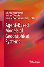
Agent Based Modelling and GIS
Just been released by Andrew Crooks, Nick Malleson, Ed Manley & Alison Heppenstall. Essential reading on ABM. Proud that it has come from our extended group in CASA and Leeds. I wrote the foreword. Click on the text to buy a copy.
If you would like to purchase my new book, click on one of the links below to view online …


Category Archives: Graphs
Visual Analytics for Urban Design
Andy and myself have done a paper for the Autumn 2014 issue of the Urban Design Journal that explores the range of visual analytics by which we mean visualisations that have an analytical meaning – 3D, maps, graphics, flows and dashboards. You … Continue reading
Posted in Big Data, Flows, Graphs, Interactions, Smart Cities
Leave a comment
Two visions of smart cities
A Review of Smart Cities: Big data, civic hackers, and the quest for a new utopia by Anthony M. Townsend and my own book The New Science of Cities by Michael Batty, by Tim Smedley in New Scientist Magazine issue … Continue reading
Posted in Big Data, city size, Complexity, Emergence, Graphs, Hierarchy, Networks, Smart Cities
Leave a comment
Urban Network Analysis Toolbox
Andre Svetsuk and the City Form Lab have just announced the Urban Networks Analysis Toolbox v1.01 for ArcGIS. This can be downloaded free. The following text is from their web site. As the first of its kind, this ArcGIS toolbox can be … Continue reading
Posted in Connectivity, Flows, Graphs, Interactions, Networks, Planning Support
Leave a comment